The History of Flooding in the Bay Area Runs Deep
March 20, 2023
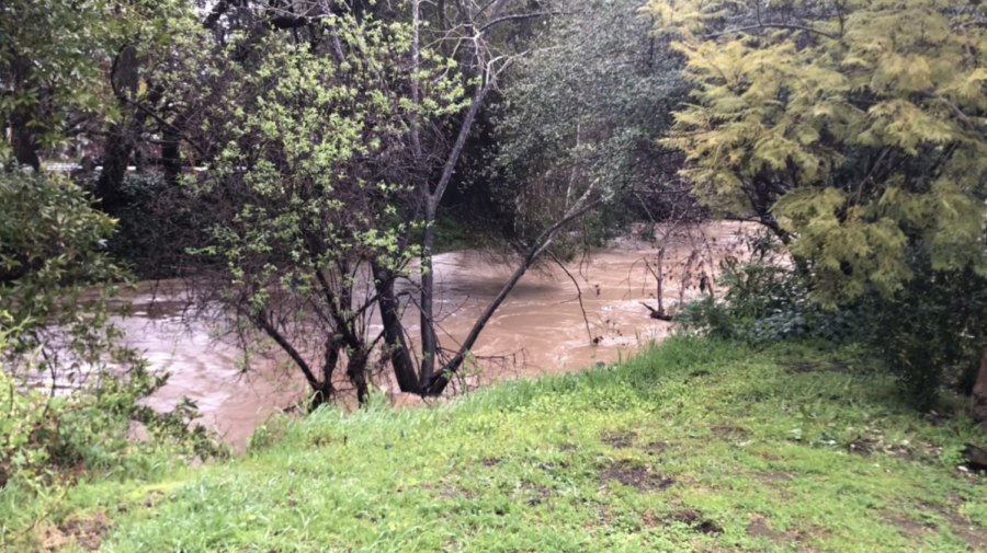
In recent episodes in late Jan. and early March, the bay area has been faced with serious storms and flooding. Residents of Palo Alto and Menlo Park in particular have watched the water level rise on numerous occasions, causing great concern. The recent storms that have laid waste to neighborhoods are part of a cycle of monster weather events that hit the Bay Area roughly every 25 years.
These powerful storms across California have been around for the past 200 years due to atmospheric rivers formed in tropical conditions in the Pacific Ocean. As these rivers make landfall along the coast, the vapor condenses into rain or ice.
While recent weather has raised great concern, this isn’t near the worst in the last 25 years. In 1998, a storm pummeled the cities of Palo Alto and Menlo Park, causing almost $40 million in damages. Clogged underpasses caused water from the San Francisquito Creek to rise and spill over its almost 20 foot tall embankments. The sheer amount of water pouring out of the creek caused almost 1,700 homeowners to move to the Cubberley Community Center for the next few days. This flood was called the “100-year flood” by many local citizens.
Before the catastrophic 1998 flood, the city of Palo Alto was flooded in 1955 on the days before Christmas. Water levels had risen dangerously high with heavy rainfall and the San Francisquito and Matadero Creeks both overflowed and spilled into the surrounding neighborhoods. Residents, including the elderly, had to forge through knee-deep water to make it to shelters set up at local schools.
Prior floods in 1911 and 1862 were much more extensive, but at the time, Palo Alto and Menlo Park were much less developed and the damage was minimal.
Since then, the city of Palo Alto has invested in fortifying the embankments of the San Francisquito Creek using rain gauges and sensors to monitor rising water levels. The San Francisquito Creek, which divides Palo Alto and Menlo Park is easily flooded as clogged underpasses slow the flow of water. Water from the sides spills over the downwards-slanted streets surrounding the creek and into the neighborhoods.
The numerous safety improvements have limited much of the damange that used to occur in major flooding incidents, but the weather has still impacted the Menlo community. English teacher Whitney Newton lives in the town of El Granada along the coast. “On the first day of remote learning [Wednesday, Jan. 4], my power went out right after I finished teaching,” Newton said. This was the first of three power outages she would experience in the next week. When the power would come back in the evening, it was not for long. “In the middle of the night, a cypress tree down the street fell and took down the power lines,” Newton said. “We didn’t have electricity for the next two weeks,” Newton said. Newton kept in touch by using WiFi at local cafes and relatives’ houses.
Despite more powerful storms, Menlo has largely stayed open aside from the recent cancelation on Mar. 15. Many Upper School buildings lost power according to an all-school email from Head of School Than Healy. Additionally, sports practices and games were allowed to continue.
